Godda district is situated between 240.47' to 250.23' Northern Latitude and between 870.08' to 870.48' Eastern Longitude in the map of India. Spread over an area of 2110 sq. Kms and having the height of 100 .414 metre. from sea level, Its eastern part from north to south is covered with forest whose area is 239.34 sq. Kms . and is a hilly track. Its western side is plain . The district is bounded by the district of Sahibganj in the north , Dumka district in the south , Pakur district in the east and Banka and Bhagalpur districts in the west. Out of the eight Prakhands of the district Boarijore and Sunderpahari fall under Area, which has special status and revenue law due to different socio-economic, ethnic and cultural values. The two blocks according to 1991 census have 63.03% and 80.52% tribal population respectively on the hills and plains . Among the rest six blocks, Poraiyahat has also 35.79% tribal population. Thus the three blocks - Boarijore , Sunderpahari & Poraiyahat together extending from north to south in the eastern part of the district shared more than 50% ( That is 1142 sq. kms. ) of the geographical area and divide the entire district distinctly in two parts . The predominating features of the tribal region, whose major part is covered by the Rajmahal hill range is rocky, infertile and dotted with hills heavily eroded slopes and degraded forest. 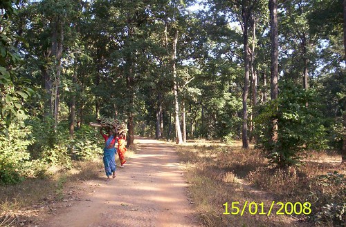 The primary occupation of the aboriginal tribes (adivasis) is hunting, sheep - rearing, animal husbandry, gathering of forest produce and traditional agriculture. The soil is of a very poor quality and is not well suited for cultivation except that of north - west part of the district owing to undulating topography. The tribals inhabiting this region following there traditional way of living , social habits and economic practices are mostly small and marginal farmers and agricultural labourers having little productive assets and mostly they have been identified as poorest of the poor. They are also exposed to exploitation of various kinds and remain no better than hewers of wood and drawers of water. History - There are no of stone weapons and tools such as axes, hammers, arrow-leads or agricultural implements found in the Santhal Pargana obviously confirmed the fact that like other parts of the world this region too had experienced the living of stone age and certainly would have been the inhabitants of this region during early Vedic age . Any record of inhabitants if available is the Indica - an account of travels of megasthenes, who visited the court of Chandragupta Maurya at Patliputra in 302 B.C and identified the race inhabiting the area has ''Maller'' (Souria Paharia). Detailed account of this region until the time of Hiuen Tsiang - a Chines pilgrim, who visited Champa about 645 A.D ,is not available. During that time the area of Santhal Pargana was under the Pal region which was the great patron of Buddhism . It was the time when the Vajrayan Sect of Buddhism was at its extreme exaltation . Signs of devi worship are available in the area which clearly signifies that the area had an impact of Buddha religion and Tantric sect. Immediately after this there is no record of the area for many centuries . But there is an interesting reference to it in the Brahmanda Section of Bhavishyat Puran which was probably compiled in the 15th or 16th century A.D from ancient materials. 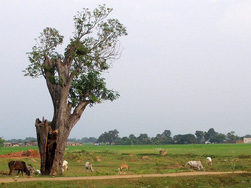 During the period of Turko-Afgan rule when Shershah Suri and his heirs were the administrators , this area was of strategic significance in course of getting possession over Bengal . Later on under Muslim rule this area was received as Jagir by Viceroy Raja Mansingh from Mugal emperor Akbar .However as regards the development of culture and civilisation the area remained abandoned till the British regime set in. The Britishers understood the strategic and economic importance of the area and thus started exploiting the jungles of the area in full force . In the beginning, the aboriginal Paharia tribe proved an obstacle to such economic exploitation of the Britishers . By 1717 the Santhal tribe which inhabited in chhotanagpur were initiated to settle in Santal Pargana by the Britishers for countering the obstacles created by the Paharias and they got success in it. But the Santals to gradually became victim of Britishers policy of exploitation and they being united rebelled against the Britishers in 1855 which was termed as '' Hul ''. This rebellion was so terrific and troublesome for the Britishers that they were compelled to accord Santhal Pargana the status of district separating it from Bhagalpur and Birbhum protecting basic facilities of aboriginal tribes and their sicio-economic structure and tradition. Present - Godda is mostly famous for the Rajmahal Coalfields in Lalmatia. Its and integral part of Jharkhand and known for its hills and small forests. The mine present here is an integral part of ECL coalfields and is among the biggest of its own in whole Asia. Until late 80's godda was full of forests and was a remote place far from science and technology and was living in a dark age as other districts of Jharkhand. The entire scenario changed after coal was first discovered under the rajmahal hills in abundance by a team of Geological Survey of India. Central Mine Planning and Design Institute Ltd conducted a detailed survey of the area. The Rajmahal Opencast Coal mine project was conceived in early 1980s, initially to supply coal to Farakka Super Thermal Power Project of NTPC, with an initial annual capacity of 5 Million tonne. For expansion of this coal mine project to 10.5 million tonne per annum, an agreement was signed between Coal India Limited and Canadian Commercial Corporation in January 1989 where MET-CHEM Canada Inc. was designated as the Canadian Executing Agency for implementing the project. The Project has been completed in July 1994 and presently being run by Eastern Coalfileds Limited personnel. Presently this mine is producing 11.5 million tonne coal per annum. This is being expanded further to 17 million tonne.  Two more mine opencast coal mine of Eastern Coalfields Limited are coming in Godda district, (1) Chuperbhita opencast coal mine project ( capacity - 4 million tonne) and (2) Hurra 'C' opencast coal mine project (capacity - 3 million tonne). ECL has its huge base in Urjanagar a govt colony inhabited by 10 thousand people. Famous Shaktipith Maa Yogini is just nearby Pathargama. |